Paklinski Islands - Popular sailing destination in Croatia
Pakleni Islands Guide for Nautical Tourists
Safe Sailing, Best Bays & Palmižana Marina
What Are the Pakleni Islands?
The Pakleni Islands (also written Paklinski otoci) are a scattered group of small, rocky and pine-covered islands lying just off the south-western coast of Hvar, in the Adriatic Sea. They stretch along the entrance to Hvar Town's harbour and form a natural playground for sailors, charter guests and day-boat visitors.
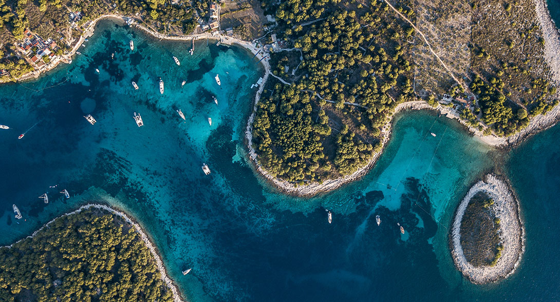
Locals often refer to the islands simply as "skoji" (islets). The name Pakleni is sometimes translated as "hell's islands", but it actually comes from the old word paklina – the pine resin or tar that was historically produced here and used to coat and protect wooden ships.
Today, the Pakleni Islands are one of Croatia's most popular nautical destinations: a compact archipelago of sheltered coves, clear water, moorings, beach bars and quiet anchorages, all just a short sail from Hvar.
Why Sail to the Pakleni Islands?
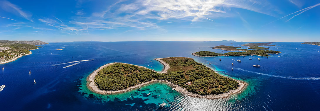
If you are planning a sailing holiday in central Dalmatia, a Pakleni Islands guide will be near the top of your list. This compact group of islets offers:
- Short distances: Ideal for relaxed cruising, especially with less experienced crew or families.
- Varied anchorages: From lively bays with restaurants and beach clubs to quiet, wild coves.
- Shelter: Good protection from many wind directions in carefully chosen bays.
- Crystal-clear water: Sandy and rocky bottoms create beautiful turquoise and pale blue tones.
- Easy access to Hvar Town: A perfect combination – sleep in quiet anchorages while enjoying Hvar's nightlife and atmosphere when you wish.
However, the Pakleni Islands also hide shoals, reefs and strong currents in places. For nautical tourists, it is essential to combine enjoyment with careful navigation.
Approaching the Pakleni Islands from Hvar
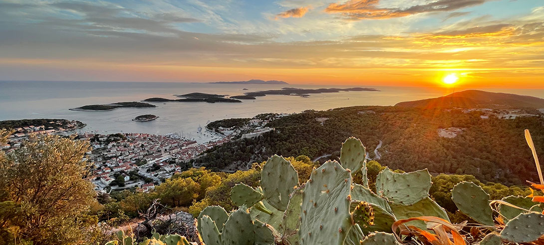
The Pakleni archipelago lies directly opposite Hvar Town. From the main harbour, it is just a short hop by:
- Charter yacht or sailing boat
- Private or rented motorboat
- Taxi boat services run regular routes in high season
For many skippers, the Pakleni Islands are a perfect first or last stop when starting or finishing a charter week from Hvar, Split, or nearby marinas.
ACI Marina Palmižana on St. Klement
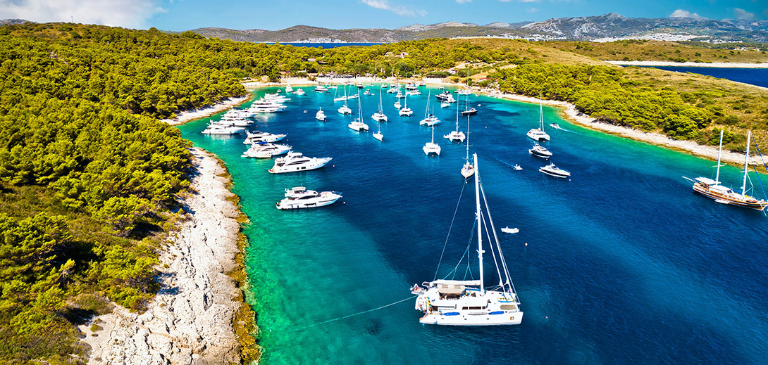
On the northern side of St. Klement (the largest of the Pakleni Islands) lies ACI Marina Palmižana, a key reference point in any Pakleni Islands Palmižana guide.
- Distance from Hvar Town by sea: around 2.4 NM
- Character: seasonal marina, usually open from spring to autumn
- Layout: originally built when 10-metre boats were considered large; today it can feel tight and crowded, with narrow fairways and limited manoeuvring space, especially for modern charter yachts.
In peak season, it's wise to:
- Arrive earlier in the afternoon if you want a berth.
- Be prepared for a busy, social atmosphere rather than a quiet, remote feel.
- Follow staff instructions carefully when entering, mooring or leaving.
Important safety note:
Even if you have a dinghy, do not attempt to cross the Pakleni Channel in a small tender when it is windy or after dark. The channel can be choppy, busy with traffic and affected by currents, particularly in the afternoon when winds often increase. Treat it as an open sea, not as a protected lake.
Anchorages & Bays in the Pakleni Islands
In addition to using the marina, many skippers prefer to anchor in the bays around the Pakleni Islands. Below are some of the best-known bays for nautical tourists.
Vinogradišće Bay (St. Klement, south side)
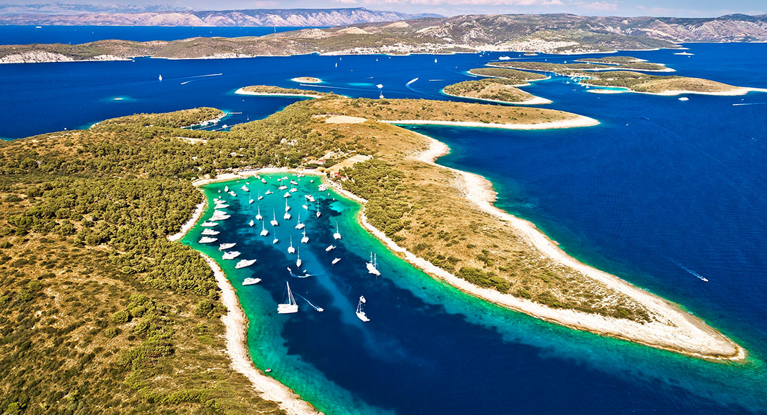
Vinogradišće Bay is one of the most popular anchorages in the Pakleni Islands and a highlight of any Pakleni Islands guide. Around the bay, you will find several restaurants and bars, typically with jetties or small piers for dinghies and taxi boats. The atmosphere is relaxed and social, perfect for an evening ashore after a day of swimming.
- Location: Southern side of St. Klement, the easternmost bay on that coast, directly opposite the islet of Stambedar.
- Shelter: Well protected from most wind directions, except strong south-westerlies, which are rare in summer.
- Depth & bottom: The bay is deep, with a predominantly sandy bottom that gives a beautiful pale blue colour and generally good holding.
- Mooring technique: In high season, the bay fills quickly. If anchoring close to shore among other boats: Drop anchor in a suitable depth. Lead one or two stern lines to the rocks on the coast. Tighten the lines to prevent swinging into neighbouring boats.
Anchoring considerations:
- The SE part of the channel is shallower than 5 m, so take care if you plan to drop anchor here.
- A good spot is usually under Planikovac, but avoid obstructing the main fairway used by other vessels. Be aware that currents can be stronger in this area. Protection from strong winds is limited, and the anchorage can become uncomfortable in adverse conditions.
For more privacy, consider moving slightly west to the quieter bays on St. Klement's western side.
Western Bays of St. Klement: Taršće, Soline, Okorija & Studeni Bok
If Vinogradišće and Ždrilac feel too crowded, sailors often look for a quieter night in the west-facing bays of St. Klement:
- Taršće
- Soline
- Okorija
- Studeni Bok
These coves generally offer a calmer, more secluded atmosphere, good swimming and snorkelling and a more "natural" feel, with fewer restaurants and less noise. As always, check depth, bottom type and swing room, and be prepared to use stern lines to the rocks in tighter spots.
Shoals, Reefs & Currents Around the Pakleni Islands
The Pakleni Islands may look like a safe playground, but nautically, they conceal numerous shoals and reefs. A proper Pakleni Islands guide for sailors must mention these hazards. Currents between the islands typically run at around 1–1.5 knots, but can reach up to about 3 knots in strong Jugo (southerly) winds. Combined with narrow passages, this can make manoeuvring more challenging, especially for less experienced skippers.
Disclaimer:
The information below is a helpful overview, not an official nautical publication. Always consult up-to-date charts, pilot books and local notices to mariners, and adjust your route for the conditions on the day.
Western Approaches – Vodnjak Veli Area
- Shoal W of Vodnjak Veli (4.5 m, marked by light): Easy to misjudge in swell or poor visibility – give wide clearance.
- Shoal NE of Vodnjak Veli (Travna–Lengva, ~2 m): Lengva Reef is hard to see until close; many yachts have grounded here. If unsure, keep further offshore.
- Karbun Reef (W of Travna): Low, dark and subtle in some light. Keep conservative course lines and cross-check chartplotter, depth and visual marks.
Central Area – Cape Ražanj & Pločica
- Cape Ražanj: Low reefs ahead of the cape are hard to spot in dull weather – slow down and watch the depth.
- Pločica Reef & Shoal (near Stambedar, ~4.5 m): Low, flat rock that blends with the sea in calm conditions, making the danger easy to underestimate.
Palmižana Approach – Baba & Gojca
- Baba Reef (entrance to Palmižana Bay): Low, dark rock with surrounding shallows; the reef extends furthest NNE, so don’t cut the turn tight.
- Shoal S of Gojca (~3 m): Midway to Planikovac. In good light, a greenish sea surface helps identify it, but in poor visibility don’t rely on colour alone.
Passages Around the Pakleni Islands: Where You Can and Cannot Sail
Some channels between the Pakleni Islands are too shallow or obstructed for safe navigation, while others are commonly used by sailors exploring the Pakleni Islands. In all cases, reduce speed, keep a sharp lookout, and be prepared to abort the passage if conditions look different from your expectations.
When Is the Best Time to Visit the Pakleni Islands?
For nautical tourists, the best time to enjoy the Pakleni Islands is typically:
Late spring and early summer (May–June)
Fewer crowds and More available moorings and anchorages. Generally pleasant sailing conditions.
Early autumn (September–early October)
The sea is still warm. Marinas and bays are less crowded. Often, the weather is more stable than during high-summer thunderstorms.
In July and August, expect:
- Much higher traffic – marinas and popular bays (like Vinogradišće and Palmižana) fill early. More wake and noise from fast boats and water taxis. Strong daily winds and choppy afternoon sea states on some days.
Shoulder seasons are often ideal for sailors who want a balance of good weather and calmer anchorages.
Practical Tips for Nautical Tourists in the Pakleni Islands
- Check weather and sea conditions before choosing your route and anchorage for the day.
- Arrive early to popular bays if you want the best spot and space to set lines.
- Use stern lines to shore wherever the anchorage is tight or when dropping anchor in deep water.
- Keep fenders ready for tight marina manoeuvres, especially in ACI Marina Palmižana.
- Avoid crossing the Pakleni Channel in a small dinghy in rough or night conditions.
- Always carry and consult updated charts or electronic navigation tools.
- Respect local regulations, no-wake zones and speed limits near swimmers and beaches.
FAQs: Pakleni Islands for Sailors
No. Many crews visit as a day or overnight stop from Hvar, Split, or other bases. However, spending several days allows you to enjoy different bays, from lively Palmižana to quieter western coves.


